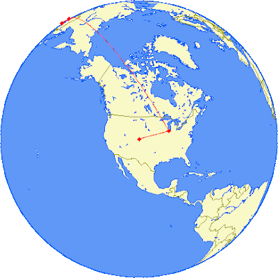


I thought this was a great idea. FlyerStats.com is now online. It lets you enter a flight path, like KDEN-KORD-ZBAA-ZGCS (Denver International to Chicago O’Hare International to BeiJing Capitol to ChangSha Datuopo and back), and see the approximate path you’ll fly. It also calculates total and per-flight mileage and cost per mile too. But then it allows you to use Great Circle Mapper to see your flight, in addition to Google Maps, which is less impressive in this situation. Looking at the world this way makes you realize why so many international flights do not fly directly over the oceans, which would look more direct in standard maps that we are used to seeing like Google Maps.
Learn Mandarin, Cantonese, or any other dialect of Chinese for FREE!


No comments:
Post a Comment